Showing posts with label Lakes. Show all posts

Thursday, 19 October 2017

Important new publication

We publish most of our research results in scientific journals that are reviewed by other researchers (or peer-reviewed).  It is an important part of sharing the knowledge that we gain from research with others, much in the same way we try to share with this blog and our Facebook page.

This week an important new paper was published in Nature Scientific Reports by the CBAWO group.  You can download a copy for free at Nature Scientific Reports.  In this, we show how recent permafrost change at Cape Bounty has made a significant impact on the lakes, changing the chemical composition of some elements by up to 500% in a few years.  This is an incredible rate of change, and this work documents how quickly this can happen and that it occurred in both lakes at the same time.  We also used the otoliths (ear bones) from Arctic char in the lakes to determine if this chemical change had influenced the fish.  We found that many elements changed abruptly in the fish otoliths at the time of the rapid changes in the lakes, signalling that the fish are responding to this environmental change.  By using a fish condition measure (by looking at length and weight of each fish), we show that the condition of the fish in the East Lake is improving, so it would seem that the permafrost change we have observed in recent years is contributing to enhanced living conditions for the fish.

Ice-push ridges on the shore of West Lake, August 2017.  Notice the cloudy water that has been that way since the winter of 2011-12.  


There is likely much more to the story, as the lake ice cover has become less persistent and water temperatures have increased as well.  The West Lake also tells an interesting story with the opposite effect:  underwater landslides (or slumps) that have made the lake continuously muddy have resulted in a continuous deterioration of the condition of Arctic char. 

So it would seem that the two lakes are going in different directions, but both are showing strong impacts from recent environmental change.

Part of the reason this paper is so important is that it summarizes work that has been carried out since 2004 at Cape Bounty, when the first lake water samples were taken and the ecosystem sampled.  We have continued this work and expanded it by working with collaborators at Environment and Climate Change Canada who are experts in contaminants in northern ecosystems, and residents of Resolute that have important knowledge about the fish and lake ecosystems.  This collaborative effort is reflected in the range of authors of this paper- each person contributed important parts of the overall story. 

Like most research, these results generate many new questions but we are working hard to pursue these.  We hope to be able to share them with you in the months and years to come!

West Lake at Cape Bounty, August 2009.

Wednesday, 1 February 2017

Lake ice cover time lapse

Have you ever wondered how ice melts on an Arctic lake?  We have time lapse cameras that take images every 30 minutes of each lake.  When we combine them into videos, you can watch the ice come off in a few minutes.

Sit back and enjoy the 2012 ice-off on East Lake!


Sunday, 11 December 2016

Imaging (and imagining) High Arctic Lakes

Guest post by Alexandre Normandeau

Maps of the lakes showing the detailed bottom bathymetry.  Blue and purple colours are the deepest areas.  
High Arctic Lakes are commonly used for environmental reconstructions because they are particularly sensitive to climate change. The Cape Bounty Arctic Watershed Observatory is probably one of the best examples of research sites that has shown the effect of climate change on landscape disturbances. The study of lake sediments can also provide information on natural hazards such as earthquakes and extreme flood events.  Ice cover is so pervasive on these lakes that it sometimes takes many years for conditions to occur that allow us to look into the lakes with modern research equipment.  After trying two previous years, in August 2015 we were finally able to finish surveying the lakes.

To analyze in great detail the history of natural hazards and climate change in the region, we brought very high-resolution echosounders in the High Arctic to map the bottom of the Cape Bounty’s lakes. These instruments emit soundwaves that travel to the bottom of the lake, and are reflected from the lakefloor before being recorded back by the echosounder. While commonly used echosounders are singlebeam (e.g., fishing echosounders), we use multibeam echosounders. This allows us to "see" on a 150° angle on each side of the boat, providing a complete image of the lake floor, similar to what Google Earth does for the land. These instruments are typically used on large research vessels and in accessible locations (near a road or human infrastructures). It was thus quite a challenge to bring our scientific equipment to such a remote location that is Cape Bounty. In collaboration with Université Laval, instead of using a large research vessel, we managed to fit our echosounder on a 7.5 m long zodiac. It is the first time that such an high-resolution mapping of lake floors is accomplished in the High Arctic.

Matt Gillman (M.Sc. student) on the Zodiac with the echosounders used in the High Arctic.


The data collected during the summer of 2015 was then corrected for vessel motion, lake-level fluctuations, sound refraction into the water, etc. The processed image of the lake-floor (Fig. 2) allowed us to understand sedimentary processes related to climate change (sea-level fluctuations, glaciations) and natural hazards (mass movements, floods).


Monday, 21 November 2016

Probing the depths of the lakes

One of the interesting things we are doing at Cape Bounty is trying to understand the contributions of groundwater to the lakes.  This is something that is very subtle and hard to measure, so we had a number of approaches to deal with this challenge in 2016.

Maddie Harasyn sampled 21 different locations in the two main lakes during the spring and summer.  We located these sites from the detailed bathymetric mapping that Alexandre Normandeau completed in 2015.  This allowed us to find the best locations to test for the presence of groundwater seeping in over the winter.
2015 Bathymetry from sidescan sonar (from Normandeau et al. 2016).  Purple and blue colours represent the deepest areas of the lakes.

Measuring the water at the bottom of the lake is a real challenge.  We use instruments that are lowered on a rope down through the lake from the ice cover.  Imagine putting something the value of a car on the end of a $5 rope and you get the idea!  We slowly lower the instrument as it collects data at 3-second intervals.  That part is very standard.

The problem is that we want to avoid touching the bottom sediment because this will disturb the last measurements and contaminant the water samples with sediment.  In 2016, we avoided this by using a live video feed on the instrument.  So as one person lowered the instrument, another carefully watched the screen.  To know when we were near the bottom, a flashlight was directed downwards.  As it approached the bottom, the beam of light came into focus and then became very small, alerting us to stop in time.

The CTD-video-light-water sampler unit.  All designed to go through a hole in the ice.
In practice, this system worked quite well.  We were able to use a fish finder to know when we were approaching the bottom (the instrument appears as a big fish) and to turn on the video system.

We are working on the results now, but this effort appears to have been worth the trouble.  It is all part of the challenges of working in the Arctic and doing research.

Tuesday, 6 September 2016

Day in the Life of an Arctic Scientist

(Contributed by CBAWO student Maddie Harasyn- Queen's University)

Science in the Arctic has turned out to be really fun! I have been here for just over two weeks and I’m actually starting to get used to the Cape Bounty routine. It usually begins with waking up at 7:30 AM to the bright light shining through the fluorescent walls of the tents we all sleep in. Then the whole crew migrates down to the Weatherhaven (what we call our mess tent) for coffee and a breakfast of either oatmeal or pancakes. We typically add excessive amounts of toppings to our breakfast to change it up a little – peanut butter, Nutella, raisins or on special mornings M&M’s. Over breakfast, we talk about all of our schedules for the day.

My schedule involves walking down to the river beside our campsite at 9 AM and collecting water samples. I then filter the water samples to measure the amount of suspended sediment, dissolved oxygen and ions in the water which involves three separate filtering processes. Often other researchers in camp offer to help me filter, as we all help out each other when we can! I then hike out to the three smaller sub-catchments that feed the river which I just sampled and collect the same water samples at each, which is about an hour and a half hike. We always go out in pairs for safety, so the hike is filled with good conversation and lots of laughs. We often find cool things on our hikes as well, like interesting rocks or full skeletons of Muskox.

Then back to filtering in our lab tent, which occupies time until lunch rolls around. For lunch, we often make soup, Kraft Dinner or eat copious amounts of peanut butter and jam on Ryvita crackers. My afternoon often consists of helping others with their research projects – like installing sensors, or hiking up to one of the sub-catchments to collect data from the loggers recording data across the landscape. It is very interesting to learn what other students are studying up here, and how their projects are coming along. Everyone has very interesting and very diverse topics, which makes every day different and exciting. To end off the day, I complete my final rounds of water sample collections at all of the sites, and filter everything before dinner. Some dinner favorites are spaghetti, burritos or chili. Over dinner, we chat about what we accomplished during the day and neat things that we all found out on the tundra. Then we head back off to bed, in the same brightness which we woke up to.


Hiking to East Lake to collect water samples.


My personal project is looking at the water chemistry in the East and West Lake to the south of our campsite. A previous researcher discovered that small depressions exist in the bottom of the lakes, which could hint that groundwater is seeping into the lakes via these sites. My project is focused on determining the source of these depressions, which I will do by studying the water chemistry in each depression. This is done by drilling holes in the lake ice, and lowering a device down the water column slowly that measures depth, electrical conductivity, temperature, dissolved oxygen and turbidity. Water chemistry samples are also collected at the bottom of each site, to be analyzed for ions and isotopes back in the lab. After lowering this device at all 22 sites, the data can be viewed on one of the lab computers and studied to help hypothesize what may be occurring at the bottom of the lake at these sites.


So far, I have found that the East Lake has mostly uniform conductivity throughout the water columns at all of the sites, whereas some specific sites in the West Lake show an increase in conductivity and decrease in dissolved oxygen with depth in the lower water column. This could suggest that groundwater is entering the lakes through these depressions, as groundwater would have a higher concentration of dissolved ions which increase the conductivity of the water at these sites. The water chemistry analyses and historic records of the disturbance patterns in this area will help consolidate this hypothesis, which will be completed as part of my thesis back at Queen’s throughout the final year of my undergraduate program.

Both lakes we are studying can be seen above: East to the left and West to the right.

Thursday, 7 November 2013

Setting sun on Cape Bounty (it will be back)

Around this time of year, the sun disappears at 75 degrees north and won't appear again until early February.  In theory, it gets completely dark, but that is really not the case.  When the moon is out and it is clear, it can be quite bright, and the snow tends to make it less than pitch black anyway.  Regardless, for all the years we have worked at Cape Bounty, we have not seen a sunset.

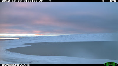
We set up time lapse cameras in 2012 to photograph both lakes hourly to determine when the ice cover formed.  These images are the last for both cameras, suitably showing a sunset (West Lake) and a sunrise (East Lake), but snow covered the cameras that night and then the November darkness came, so we don't know what happened after that.  The cameras worked well in the cold temperatures, but stored thousands of black or blurred images.  We relocated the cameras for 2013-14, so hopefully we'll be able to get that last light around now...


Sunday, 15 September 2013

Retrospect on 2013 Lake Ice

In many respects, 2013 seemed cold and rainy at Cape Bounty.  After the past five years where we have routinely had warm, sunny conditions and little summer rainfall, 2013 seemed like a throwback to the past, almost like the Little Ice Age of the 19th century.   The ice on the West and East Lakes seemed to support this notion, and were frustratingly uncooperative with our plans to carry out detailed side-scan sonar and sediment acoustic surveys in late July and early August.  We were reasonably successful with the East Lake, where the ice broke up substantially during the period we were working, but the West Lake skunked us completely.  In most respects, 2013 was still an above average summer in terms of mean temperatures and rainfall.  It is just that compared to recent years, it did not feel as warm.


One of the nice things about working with a diverse research group is that you get to see your own work through a different lens.  This image, from Canada's Radarsat 2 was taken on August 9, 2013, a week after we left the camp at Cape Bounty.  It clearly shows the residual ice on both lakes, and indicates that we would have still been waiting for the ice to clear on the West Lake.

Interestingly, you can still see ice pans on the ocean as well, although the ice cover usually reaches a minimum in mid-September.

Thanks to Ashley Rudy for the image (courtesy of the Canadian Space Agency).