We have not posted here in a long time and don't plan on doing so again. You will find us on Facebook:
https://www.facebook.com/CBAWO/
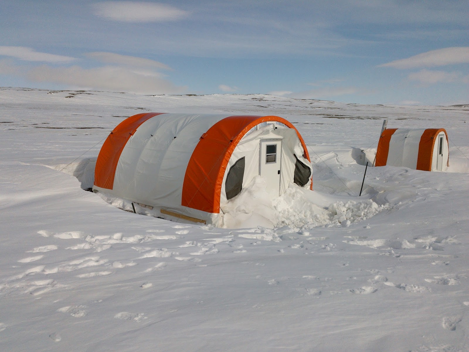
Monday, 10 September 2018
Tuesday, 2 January 2018
Sharing science at Arctic Change meeting
Guest post by M.Sc. student Gillian Thiel
 |
| Gillian baking muffins on a rare sunny day! |
What happens when you gather many of the world’s leading
Arctic researchers, northerners, enthusiastic graduate students, and government
officials in one building during a the biggest snowstorm of the year? A pretty
amazing conference!
During the week of Dec. 11 – 15th, a handful of
professors and students from the Cape Bounty research team braved the impending
snow to attend the international Arctic Change 2017 conference in Québec City.
It was possibly the final time that researchers from around the world would
have the opportunity to meet under the umbrella of the ArcticNet funding
program. It did not disappoint.
Student Day (Dec. 11th) was a fantastic day
planned by students for students and included an elevator-pitch competition, panel
discussions, and workshops on topics such as data management and bridging
northern and southern perspectives on arctic research priorities.
Over the week, I had the opportunity to attend a variety of
sessions on topics including ocean biogeochemistry, rapid changes in extreme
environments, and vulnerability, adaptation and resilience to climate change in
the Arctic.
One of the most memorable presentations was one by Ed
Zebedee about how the community of Pangnirtung, Nunavut dealt with a major
power plant failure in 2015. It highlighted some of the major barriers to
living in the north such as ill-equipped airports and the difficulties of
shipping large equipment to remote communities. However, Mr. Zebedee’s
presentation also highlighted the incredible resilience and adaptability of
Pangnirtung residents, the efficacy of the emergency management plans that were
in place, and the initiative of the Canadian Rangers. You can read more about
the power failure here.

I also had the opportunity to attend panel discussions
including one on the politics surrounding defense and development in the
Northwest Passage led by the Honourable Minister Laurence Cannon and featuring
Hannah Uniugsaraq (Director of Nunavut Tunngavik), Lindsay
Rodman, Suzanne
Lalonde, Tom
Lawson, and Michael
Byers. It was an impressive panel.

But, what made the whole week truly unforgettable were the
people I met. Arctic Change 2017 gave me the opportunity to interact with
researchers from around the world. They gave me insight into my own research,
and also exposed me to science I knew nothing about in regions of the Arctic I
had never even heard of! Overall, the Arctic Change 2017 was a fantastic, fun,
and educational experience.
Friday, 1 December 2017
More reflections on 2017 field work
Guest post by Jackie Hung:
Going to Cape Bounty for a second field season, the novelty of
High Arctic field work has still not worn off. Seeing the Weatherhaven tents
through the window of the Twin Otters as we circled the cape brought back all the
memories of the previous season. That is, until we had to dig out the tents
from over 2 metres of snow.
Opening camp was a completely new, rewarding, and humbling experience.
Seeing the landscape transform from late-winter conditions to spring and summer
growth gave me a new perspective on the amount of change that the land
undergoes and the harsh environment that the flora and fauna endure here. I was
able to finally see and take part in some of the research and data collection
that is undertaken in the early season, including lake sampling and river
channelizing. Coming to the field before the growing season has also given us
the chance to see the birds in their nesting season. Camp has been frequented
by several visitors so far, including large muskox herds, curious caribou, and
large Arctic hares.
 |
| Snow sampling and working with data loggers that record soil temperature year-round at Cape Bounty. |
In 2017, my day-to-day activities included taking static CO2
measurements, trace gas sampling, spectroradiometer work, and soil sampling.
Carbon exchange autochambers and buried soil moisture and temperature loggers
are allowing me to take continuous measurements in various locations to
complement my seasonal data set. Soil samples taken from the field will be used
towards laboratory experiments that will allow me to manipulate different
biophysical features to see the microbial response the soils to elevated
temperature and fertilization. This field season has given me a head start to
the sampling for my new role as a Queen’s student and will help in formulating
the questions that will form the basis of my Ph.D.
Thursday, 19 October 2017
Important new publication
We publish most of our research results in scientific journals that are reviewed by other researchers (or peer-reviewed). It is an important part of sharing the knowledge that we gain from research with others, much in the same way we try to share with this blog and our Facebook page.
This week an important new paper was published in Nature Scientific Reports by the CBAWO group. You can download a copy for free at Nature Scientific Reports. In this, we show how recent permafrost change at Cape Bounty has made a significant impact on the lakes, changing the chemical composition of some elements by up to 500% in a few years. This is an incredible rate of change, and this work documents how quickly this can happen and that it occurred in both lakes at the same time. We also used the otoliths (ear bones) from Arctic char in the lakes to determine if this chemical change had influenced the fish. We found that many elements changed abruptly in the fish otoliths at the time of the rapid changes in the lakes, signalling that the fish are responding to this environmental change. By using a fish condition measure (by looking at length and weight of each fish), we show that the condition of the fish in the East Lake is improving, so it would seem that the permafrost change we have observed in recent years is contributing to enhanced living conditions for the fish.
There is likely much more to the story, as the lake ice cover has become less persistent and water temperatures have increased as well. The West Lake also tells an interesting story with the opposite effect: underwater landslides (or slumps) that have made the lake continuously muddy have resulted in a continuous deterioration of the condition of Arctic char.
So it would seem that the two lakes are going in different directions, but both are showing strong impacts from recent environmental change.
Part of the reason this paper is so important is that it summarizes work that has been carried out since 2004 at Cape Bounty, when the first lake water samples were taken and the ecosystem sampled. We have continued this work and expanded it by working with collaborators at Environment and Climate Change Canada who are experts in contaminants in northern ecosystems, and residents of Resolute that have important knowledge about the fish and lake ecosystems. This collaborative effort is reflected in the range of authors of this paper- each person contributed important parts of the overall story.
Like most research, these results generate many new questions but we are working hard to pursue these. We hope to be able to share them with you in the months and years to come!
This week an important new paper was published in Nature Scientific Reports by the CBAWO group. You can download a copy for free at Nature Scientific Reports. In this, we show how recent permafrost change at Cape Bounty has made a significant impact on the lakes, changing the chemical composition of some elements by up to 500% in a few years. This is an incredible rate of change, and this work documents how quickly this can happen and that it occurred in both lakes at the same time. We also used the otoliths (ear bones) from Arctic char in the lakes to determine if this chemical change had influenced the fish. We found that many elements changed abruptly in the fish otoliths at the time of the rapid changes in the lakes, signalling that the fish are responding to this environmental change. By using a fish condition measure (by looking at length and weight of each fish), we show that the condition of the fish in the East Lake is improving, so it would seem that the permafrost change we have observed in recent years is contributing to enhanced living conditions for the fish.
 |
| Ice-push ridges on the shore of West Lake, August 2017. Notice the cloudy water that has been that way since the winter of 2011-12. |
There is likely much more to the story, as the lake ice cover has become less persistent and water temperatures have increased as well. The West Lake also tells an interesting story with the opposite effect: underwater landslides (or slumps) that have made the lake continuously muddy have resulted in a continuous deterioration of the condition of Arctic char.
So it would seem that the two lakes are going in different directions, but both are showing strong impacts from recent environmental change.
Part of the reason this paper is so important is that it summarizes work that has been carried out since 2004 at Cape Bounty, when the first lake water samples were taken and the ecosystem sampled. We have continued this work and expanded it by working with collaborators at Environment and Climate Change Canada who are experts in contaminants in northern ecosystems, and residents of Resolute that have important knowledge about the fish and lake ecosystems. This collaborative effort is reflected in the range of authors of this paper- each person contributed important parts of the overall story.
Like most research, these results generate many new questions but we are working hard to pursue these. We hope to be able to share them with you in the months and years to come!
 |
| West Lake at Cape Bounty, August 2009. |
Wednesday, 6 September 2017
Sediment research in 2017
Guest post by Casey Beel, Ph.D. candidate
This season was interesting for High Arctic hydrology.
Total snowfall, and snow water equivalence estimates, was amongst the highest
at Cape Bounty since monitoring began in 2003. This year also saw a significant
delay in the initiation of snowmelt and channel flow, with the start of
discharge not beginning until June 22 - the second latest day of first flow in
our records. This change to the hydrology creates more questions about how this
year will fit into our longer term record and what increased snowfall means for
suspended sediment transfer.
 |
| Camping out at the West River station during a long sampling campaign. |
The main objective of my research this year was to gain a
better understanding of the temporal patterns of suspended sediment transfer.
To do this, I spent 15 hours camped out in my waders, with a deck chair for
comfort, and over 200 sample bottles, collecting water every 10 minutes from
the West River. Thankfully, I choose a perfect day for this saga - with blue
skies and warm temperatures. Across the river, two Greater Snow Geese have
chosen a small grassy knoll to nest, and for the majority of my day, they were
my only company, and as the hours drew on, I began to realize that they weren’t
great conversationalists.
 |
| West River at full runoff. |
One of the exciting additions to my research is that it is
spatially distributed across multiple catchments. This allows me the
opportunity to explore the landscape and find exciting new landscape features,
fossils, and even marine shells that are emerging from degrading slopes. So far
this year, we have discovered a newly forming landscape disturbance in the
lower East River catchment, revisited the expanding retrogressive thaw slump to
the north of camp, and collected enough rocks for my collection to warrant an
extra bag of luggage for the trip home.
Wednesday, 23 August 2017
What grows here....
Guest post from M.Sc. student Valerie Freemantle
I am happy to say that my sampling has been going well and that Cape Bounty has started to feel like home. I wake up every morning looking out to the weather haven and West Lake. The days are long, but being outside and surrounded by science all day makes it such a rewarding place to work.
For my thesis, I am using digital pictures and satellite imagery in order to see if there has been any change in the vegetation cover at Cape Bounty since 2004. In the field, I have been revisiting plots that were sampled in 2004 and 2008 and using digital images to estimate the percent coverage of vegetation. When I return to Kingston, I will use these images to scale up to the satellite imagery this year. Then, I can relate these pictures and the data from 2004 and 2008 to satellite imagery and determine if there has been any change in vegetation between 2004 and 2017.
The vegetation in the Arctic has to be able to survive in some difficult conditions. The Arctic growing season is short and there is little on the landscape to block the wind. However, flowers still manage to survive in the slight depressions in the landscape where trickles of water flow soon after snowmelt.
For example, here are some Arctic poppies (Igutsat niqingit, Papaver spp.) blowing on a slope. They are all pointing towards the (never setting) summer sun. The areas where they have managed to establish themselves are in slight depressions where enough water flows to support lichens, mosses and flowers.
Another very common plant is the purple saxifrage (Aupilattunnguat, Saxifraga oppositifolia). This is the territorial flower of Nunavut. These little flowers provide bursts of colour all over Cape Bounty.
The
real powerhouse of sequestration in the Arctic is made up of vegetation like
mosses and sedges. I need some more work learning to tell these apart, but
there are many varieties of sedges and grasses at Cape Bounty. Here is a
picture of some sedge and moss growing in a small water rack at the side of a
rocky slope. The vegetation out here is pretty awesome.
Knowing how much vegetation is on the landscape is important. Vegetation is an important mechanism for removing carbon from the atmosphere and storing it. Generally, the Arctic has been considered a net sink of carbon, meaning that it stores more than it produces. Mosses and sedges are a big component of this storage. But, with the anticipated changes in Arctic climate due to climate change, there is the potential that this trend may change. Thus, the next step of my project will be to link any changes in vegetation cover to changes in carbon sequestration. I am planning on doing this by relating the trends in vegetation growth from the satellites to measurements of carbon intake and output from eddy covariance towers here at Cape Bounty.
I am happy to say that my sampling has been going well and that Cape Bounty has started to feel like home. I wake up every morning looking out to the weather haven and West Lake. The days are long, but being outside and surrounded by science all day makes it such a rewarding place to work.
 |
| A view from the tent! |
For my thesis, I am using digital pictures and satellite imagery in order to see if there has been any change in the vegetation cover at Cape Bounty since 2004. In the field, I have been revisiting plots that were sampled in 2004 and 2008 and using digital images to estimate the percent coverage of vegetation. When I return to Kingston, I will use these images to scale up to the satellite imagery this year. Then, I can relate these pictures and the data from 2004 and 2008 to satellite imagery and determine if there has been any change in vegetation between 2004 and 2017.
The vegetation in the Arctic has to be able to survive in some difficult conditions. The Arctic growing season is short and there is little on the landscape to block the wind. However, flowers still manage to survive in the slight depressions in the landscape where trickles of water flow soon after snowmelt.
For example, here are some Arctic poppies (Igutsat niqingit, Papaver spp.) blowing on a slope. They are all pointing towards the (never setting) summer sun. The areas where they have managed to establish themselves are in slight depressions where enough water flows to support lichens, mosses and flowers.
 |
| Arctic poppies |
Another very common plant is the purple saxifrage (Aupilattunnguat, Saxifraga oppositifolia). This is the territorial flower of Nunavut. These little flowers provide bursts of colour all over Cape Bounty.
 |
| Purple saxifrage |
 |
| Moss and sedges |
Knowing how much vegetation is on the landscape is important. Vegetation is an important mechanism for removing carbon from the atmosphere and storing it. Generally, the Arctic has been considered a net sink of carbon, meaning that it stores more than it produces. Mosses and sedges are a big component of this storage. But, with the anticipated changes in Arctic climate due to climate change, there is the potential that this trend may change. Thus, the next step of my project will be to link any changes in vegetation cover to changes in carbon sequestration. I am planning on doing this by relating the trends in vegetation growth from the satellites to measurements of carbon intake and output from eddy covariance towers here at Cape Bounty.
Thursday, 27 July 2017
2017 field season underway
Post by Casey Beel, Ph.D. student
This season has been interesting for High Arctic hydrology. Total snowfall, and snow water equivalence estimates, was amongst the highest at Cape Bounty since monitoring began in 2003. This year also saw a significant delay in the initiation of snowmelt and channel flow, with the start of discharge not beginning until June 22 - the second latest day of first flow in our records. This change to the hydrology creates more questions about how this year will fit into our longer term record and what increased snowfall means for suspended sediment transfer.
One of the exciting additions to my research is
that it is spatially distributed across multiple catchments. This allows me the
opportunity to explore the landscape and find exciting new landscape features,
fossils, and even marine shells that are emerging from degrading slopes. So far
this year, we have discovered a newly forming landscape disturbance in the
lower East River catchment, revisited the expanding retrogressive thaw slump to
the north of camp, and collected enough rocks for my collection to warrant an
extra bag of luggage for the trip home. With a month left in my season, I am
hoping for more, exciting scientific and curiosity based discoveries.
 |
| Casey waiting for the next sample at the West River. Snow geese are unimpressed with hydrological research! (photo: P. Treitz) |
This season has been interesting for High Arctic hydrology. Total snowfall, and snow water equivalence estimates, was amongst the highest at Cape Bounty since monitoring began in 2003. This year also saw a significant delay in the initiation of snowmelt and channel flow, with the start of discharge not beginning until June 22 - the second latest day of first flow in our records. This change to the hydrology creates more questions about how this year will fit into our longer term record and what increased snowfall means for suspended sediment transfer.
The main objective of my research this year is to gain a
better understanding of the temporal patterns of suspended sediment transfer.
To do this, I spent 15 hours camped out in my waders, with a deck chair for
comfort, and over 200 sample bottles, collecting water every 10 minutes from
the West River. Thankfully, I choose a perfect day for this saga - with blue
skies and warm temperatures. Across the river, two Greater Snow Geese have
chosen a small grassy knoll to nest, and for the majority of my day, they were
my only company, and as the hours drew on, I began to realize that they weren’t
great conversationalists.
Wednesday, 14 June 2017
Resolute Qarmartalik School Science Fair
 |
| Bad weather in Resolute during late winter. |
Bad weather can be frustrating when your excitement to begin
summer research is at a high. You have all your personal gear packed. You have
spent two days organizing everything you need for the next month. All of your scientific equipment is ready to
be installed. But the weather keeps changing. Snow keeps falling. Visibility is
poor. And planes remain grounded. This can be trying. But then an opportunity
to visit the community and participate in the science fair at the school is
presented to you. You forget about the fact that there are delays in getting to
the field and you remember that outreach opportunities like this are one of the
reasons we are involved in Arctic research.
For the last four years, the Polar Continental Shelf Program
(PCSP), Natural Resources Canada (NRCAN), have sponsored a
science fair for Grades 1-11 at the Qarmartalik School in Resolute Bay. This
year, students presented their research on which form of renewable energy would
have the greatest benefit for Resolute, how to better insulate housing in the
community, the best toothpaste to use to protect their teeth, the best compost to
use in this environment, and many other topics that the students were either
passionate about or that were directly relevant to their day-to-day lives in
the Arctic.
 |
| Researcher Neal Scott with several students at the Qarmartalik School Science Fair. NRCat was also on hand for the festivities! [picture posted with permission of parents and school] |
We were fortunate enough to be invited to judge this year’s science fair along with other community members (e.g., the RCMP) and encourage the students’ scientific curiosities. This opportunity also enabled us to meet and talk with the parents and teachers of this remote community. We were shown traditional tools used to clean and stretch animal hides. We were each given syllabic charts to encourage us to learn how to write our names in Inuktitut, and we were taught a traditional game, where the goal is to be the first person to get the end of their stick into one of the small holes drilled into a caribou antler. But for the children (and ourselves if we are being honest), the best part of the day was a visit from the Natural Resources Cat (NRCat) – for which it didn’t take long for the kids to “de-tail” the costume (3 minutes to be exact).
It was a great day to share the excitement of science with the children of Resolute!
Sunday, 12 February 2017
Polar Continental Shelf Program
We are working hard to get ready for our 2017 field season at CBAWO. There is a lot to organize- people, schedules, equipment, flights, and funding. It is a job that seems to start about a month after we return from the field and continues for most of the year- and in reality it is just that. There is a lot of work in the background that makes research at CBAWO and other projects across the Canadian Arctic possible.
One group that deserves a lot of credit for our research success is the Polar Continental Shelf Project (PCSP). This small program is part of Natural Resources Canada, the national government, and has been operating in the the Arctic since 1958. It is probably not an overstatement to suggest that PCSP has supported almost every major research project in the High Arctic over the years, involving thousands of researchers. Many of the projects are based in Resolute or other communities in the Arctic, but a large number of them are like ours, located in remote field camps scattered over an area the size of western Europe. PCSP has been a bedrock support for all of this research, by providing logistics, aircraft, vehicles, field equipment, and a base of operations in Resolute where they can seemingly help you with any problem. They also have a well-earned reputation for serving great food in their cafeteria and there is nothing like cleaning up with a hot shower and reconnecting with the world after a long field season at the PCSP base.
PCSP facilities have changed quite a bit over the years but the core of the operation is an accommodation building and a warehouse where equipment is stored and maintained. The accommodation building has expanded over the years, most recently in 2011 when a joint effort with the Canadian Military resulted in a significant expansion. This collaboration means that military training operations have a home in the High Arctic, and researchers can use the facilities at other times. They can hold and feed over 200 people, and when the weather is bad and flights are not moving, they can find themselves with a full house!
The PCSP warehouse is a huge building filled with field equipment. There is seemingly everything there: tents, drills, boats, snow machines, radios, and every kind of camping gear. There is a full mechanics shop for keeping everything thing running smoothly and those "can you help me with this?" moments. They have a supply of fuel for everything, all planned the year before and brought up on the sealift in September. Upstairs there are storage spaces for us to leave equipment over winter, which saves a tremendous amount of freight expense for researchers.
Perhaps the most important aspect of PCSP is the access to charter aircraft they facilitate and support. Small planes like the Twin Otter in the picture below are the workhorses of the Arctic, able to land on almost any surface and move equipment and people to the most remote parts of the Arctic. PCSP usually has 1-2 of these aircraft on contract, as well as helicopters and even larger planes when the need arises. Aside from facilitating the use of the aircraft for researchers, PCSP Base Managers work to make the most of these planes. That often means arranging sharing of flights and using unused return flights for other purposes. This is no small task to manage, and when the meter is running at about $2500 each hour, this effort is really critical to stretch research budgets. The process of dispatching flights is complicated and will be the subject of another post, but suffice to say it is something that the research community that PCSP serves is really dependent on!
There are many other partners that make our research possible, but there are few that seem to do as much with so little as PCSP. They are really one of Canada's great successes that more people should know about. When the rest of the world plans to develop their polar research support, they have come to PCSP to learn how to do it.
 |
| Based in Resolute, Nunavut, PCSP is a logistics support agency that makes Arctic research possible. |
PCSP facilities have changed quite a bit over the years but the core of the operation is an accommodation building and a warehouse where equipment is stored and maintained. The accommodation building has expanded over the years, most recently in 2011 when a joint effort with the Canadian Military resulted in a significant expansion. This collaboration means that military training operations have a home in the High Arctic, and researchers can use the facilities at other times. They can hold and feed over 200 people, and when the weather is bad and flights are not moving, they can find themselves with a full house!
 |
| The PCSP accommodation and lab buildings in mid-May. Staff have been working since January with researchers and military training exercises. |
The PCSP warehouse is a huge building filled with field equipment. There is seemingly everything there: tents, drills, boats, snow machines, radios, and every kind of camping gear. There is a full mechanics shop for keeping everything thing running smoothly and those "can you help me with this?" moments. They have a supply of fuel for everything, all planned the year before and brought up on the sealift in September. Upstairs there are storage spaces for us to leave equipment over winter, which saves a tremendous amount of freight expense for researchers.
 |
| Putting it together in the warehouse. A load arranged to fly out to the field camp with everything you need to survive and do science. |
Perhaps the most important aspect of PCSP is the access to charter aircraft they facilitate and support. Small planes like the Twin Otter in the picture below are the workhorses of the Arctic, able to land on almost any surface and move equipment and people to the most remote parts of the Arctic. PCSP usually has 1-2 of these aircraft on contract, as well as helicopters and even larger planes when the need arises. Aside from facilitating the use of the aircraft for researchers, PCSP Base Managers work to make the most of these planes. That often means arranging sharing of flights and using unused return flights for other purposes. This is no small task to manage, and when the meter is running at about $2500 each hour, this effort is really critical to stretch research budgets. The process of dispatching flights is complicated and will be the subject of another post, but suffice to say it is something that the research community that PCSP serves is really dependent on!
 |
| Waiting for the next trip- a Twin Otter at the PCSP base in Resolute. |
Wednesday, 1 February 2017
Lake ice cover time lapse
Have you ever wondered how ice melts on an Arctic lake? We have time lapse cameras that take images every 30 minutes of each lake. When we combine them into videos, you can watch the ice come off in a few minutes.
Sit back and enjoy the 2012 ice-off on East Lake!
Sit back and enjoy the 2012 ice-off on East Lake!
Monday, 16 January 2017
QUAWLity- a new laboratory for research at Cape Bounty

As the research program has become more complex at Cape Bounty, we have needed increasingly sophisticated laboratory facilities and increased amounts of power in the lab. This is not a trivial issue in a remote camp. In the past we have made due with temporary lab tents and used a portable generator, but these conditions were less than ideal and the generators were noisy, need gasoline and ultimately can be unreliable. This is the story of how we built our new lab facility, QUAWLity (Queen's University Arctic Watershed Laboratory).
With support from the Canadian Government Natural Sciences and Engineering Research Council (NSERC), QUAWLity moved from the drawing board to reality. We shipped up the Weather Haven tent and arranged wood for the floor from a supplier in Resolute. It all arrived in camp in early August 2015 and construction began.
The floor was first to be built. We are not allowed to put in permanent foundations, so we placed the wooden floor on blocks and built it with insulation and linoleum to make it cleaner and warmer.

It was a group effort to build the tent. Conditions were calm and foggy, perfect for handling the large tent pieces. These tents are very well designed and have robust metal frames and vinyl covers that are suitable for long term exposure. The tent went up quickly despite the dreary weather.

The construction crew, just before cutting the front door out.

The finished tent, secured to the ground with long metal stakes and metal guy wires.

That was it for 2015, we left the tent empty until 2016. Arriving in May, you never quite know what to expect, but other than a bit of loose material at the front, all well well. These tents create large snow drifts, but the upwind side is usually bare of snow.
The first order of business was installing the propane wall furnace. Dr. Benjamin Amann was eager to help!

We organized the lab into a series of workstations where sample filtering and handling could be carried out. The fume hood was a nice addition that allows safe handling of acids needed to stabilize some samples and a propane chest freezer means no more running the generator to keep the cooler frozen.

The last part of the set up was a solar system. Inside the tent are a panel for the electronics and a cooler for the AGM deep cycle batteries. These batteries are designed not to freeze so they are safe to use in this setting and the cooler provides further protection from temperature extremes. A temperature logger placed with the batteries showed that they stayed at -30degC or warmer, compared to almost -50degC outside at times. They were fully charged when we arrived in mid-May

The 300W of solar panels are on a wooden frame outside, secured down with guy wires. The orientation is perfect to have the wind scour the panels and keep them clear of snow in the winter. Even though we have 24-hour daylight during field seasons, the midnight sun does not charge our batteries!

Monday, 2 January 2017
Biogeochemical Research in the High Arctic
Hi! My
name is Gillian and I’m a first-year Master’s student at Queen’s. Dr. Melissa
Lafrenière, co-manager of the Queen’s Facility for Biogeochemical Research on
Environmental Change and the Cryosphere (FABRECC: http://www.queensu.ca/geographyandplanning/fabrecc-lafreniere/home)
is my supervisor. We are working to better understand biogeochemical processes
at the Cape Bounty Arctic Watershed Observatory. In other words, we study the
interactions between the physical, chemical, biological, and geological
processes occurring in the High Arctic permafrost environment.
Specifically,
I study carbon in organic matter. The permafrost of the Arctic stores huge
amounts of organic carbon. In fact, researchers estimate that there is twice as
much carbon stored in the permafrost as there is carbon in the atmosphere right
now. As permafrost degrades due to warming temperatures, some of the permafrost
carbon could be released to the atmosphere as greenhouse gases such as carbon
dioxide and methane.
Why will only some of the carbon be
released? Well, only a portion of the permafrost carbon is decomposable, and
carbon must undergo decomposition to produce greenhouse gases. My job is to
determine what makes the carbon decomposable and identify where the
decomposable carbon is likely to be found on a High Arctic landscape.
Knowing how much carbon is
decomposable, and where it’s located, is important for developing climate
models. Because data on decomposable carbon are limited, carbon stored in
permafrost isn’t well incorporated into current climate models. The results of
our research could change that. For example, if we know there is a lot of decomposable
carbon stored in areas highly susceptible to enhanced permafrost thaw, then we
might conclude there is a high probability of greenhouse gas emissions in those
areas. This increased probability can then be accounted for in climate model
projections, making them more accurate.
 |
A soil profile at one of
my sampling sites at the Cape Bounty Arctic Watershed Observatory on Melville
Island, NU.
|
I collected soil and water samples from sites with varying geomorphology and vegetation at Cape Bounty during the summer of 2016. Back in the lab at Queen’s, I incubated these samples for twenty-eight days. During an incubation, the samples were kept a constant temperature. At specific time points throughout the incubation period, I removed a subset (or aliquot) of each sample and analyzed it to characterize the molecular structure of its carbon compounds and its organic carbon concentration.
Now that the incubation period is
finished, I can calculate how much organic carbon was lost (through
decomposition) over the twenty-eight days. Better yet, I can compare these data
with the molecular structure of the carbon compounds to see if molecular
structure is an indicator of decomposability. If they are related, it would be
really exciting since the methods used to characterize molecular structure are
much easier to perform than the incubations. If molecular structures could be
used to predict carbon decomposability instead of incubations, it would save
researchers a lot of time and money!
 |
An emission excitation matrix (EEM), like the one shown above, provides insight into the molecular structure of carbon compounds in water samples.
|
The next step for my project will
be to look at how the decomposability of carbon varies by sample site. If we
identify a relationship between carbon decomposability and study site
characteristics, we could use this to predict how carbon decomposability will vary
across the broader landscape. For example, if we find that carbon
decomposability is related to a certain vegetation community, we could use
vegetation cover maps to predict how carbon decomposability varies across the
landscape.
The best part about my project is
that I get to go back to Cape Bounty next summer for a second field season. So,
based on what I find out from the lab work I’m doing now, I can tailor my 2017
sampling plan to better address my research questions. Stay tuned for more
results and stories about field season preparations later this winter!
Sunday, 11 December 2016
Imaging (and imagining) High Arctic Lakes
Guest post by Alexandre Normandeau
 |
| Maps of the lakes showing the detailed bottom bathymetry. Blue and purple colours are the deepest areas. |
To analyze in great
detail the history of natural hazards and climate change in the region, we
brought very high-resolution echosounders in the High Arctic to map the bottom
of the Cape Bounty’s lakes. These instruments emit soundwaves that travel to
the bottom of the lake, and are reflected from the lakefloor before being
recorded back by the echosounder. While commonly used echosounders are singlebeam (e.g., fishing echosounders),
we use multibeam echosounders. This allows
us to "see" on a 150° angle
on each side of the boat, providing a complete image of the lake floor, similar
to what Google Earth does for the land. These instruments are
typically used on large research vessels and in accessible locations (near a
road or human infrastructures). It was thus quite a challenge to bring our
scientific equipment to such a remote location that is Cape Bounty. In
collaboration with Université Laval, instead of using a large research vessel, we managed to fit our
echosounder on a 7.5 m long zodiac. It is the first time that such an
high-resolution mapping of lake floors is accomplished in the High Arctic.
 |
| Matt Gillman (M.Sc. student) on the Zodiac with the echosounders used in the High Arctic. |
The data
collected during the summer of 2015 was then corrected for vessel motion,
lake-level fluctuations, sound refraction into the water, etc. The processed
image of the lake-floor (Fig. 2) allowed us to understand sedimentary processes related to
climate change (sea-level fluctuations, glaciations) and natural hazards (mass
movements, floods).
Monday, 28 November 2016
Life at Cape Bounty
Guest post by M.Sc. student Amanda Schevers
 |
The best way to carry the stand for the
precipitation collectors. This is at the top of the West River catchment, I’m just
about to install the final collector.
|
I never thought I would ever
consider battling snowstorms, bone-chilling winds, and sub-zero temperatures
for an entire summer to be so rewarding and fun, yet somehow I ended up at Cape
Bounty. Despite hearing stories from past students, seeing pictures, and
reading more papers than I can remember, I still managed to be completely
shocked when I hopped off the plane onto the lake ice. No pictures will ever do
this place justice.
But
why am I here, in an uninhabited island in the middle of the High Arctic?
Sometimes, when I get caught up in the small details of things, stepping back
and re-reading my research proposal helps remind me what I am actually trying
to accomplish while I am here (which, by the way is for a total of 64 days).
We’ve heard all about climate change and how much it will change the world we
live in, but how exactly is it going to change the surface water we, and
countless aquatic ecosystems rely on?
To help answer this question, I’m going
to be monitoring two rivers and their respective watersheds. This may sound
easy, but it means I’m going to end up hiking 15-20 km carrying 10-12 litres of
water every single day. Luckily I have PhD candidate Casey to help me out. We
installed a network of monitoring stations, wells to collect subsurface water,
and four precipitation collectors across the landscape. My first week at camp
was spent out on the tundra, getting to know the land, the equipment, and
getting a taste of the wide range of research that occurs at Cape Bounty.
One
of the best parts of hiking such a large area every day is the chance to see so
many incredible things. Hiking up through snow lined channels, stopping to
admire the approaching wolves, caribou, and muskox, and checking out all the
bones scattered across the tundra are some of my favourites.
 |
| Before installing stations, we decided to walk up the East river channel. Water creates some pretty cool features. |
Life
at camp hasn’t been too shabby either. We’ve managed to bake a giant cookie,
brownie, and apple crisp all in a frying pan. After a long, cold day in the
field and in the lab a relaxing evening with dessert and camp stories are the
perfect way to end the day.
Monday, 21 November 2016
Probing the depths of the lakes
One of the interesting things we are doing at Cape Bounty is trying to understand the contributions of groundwater to the lakes. This is something that is very subtle and hard to measure, so we had a number of approaches to deal with this challenge in 2016.
Maddie Harasyn sampled 21 different locations in the two main lakes during the spring and summer. We located these sites from the detailed bathymetric mapping that Alexandre Normandeau completed in 2015. This allowed us to find the best locations to test for the presence of groundwater seeping in over the winter.
Measuring the water at the bottom of the lake is a real challenge. We use instruments that are lowered on a rope down through the lake from the ice cover. Imagine putting something the value of a car on the end of a $5 rope and you get the idea! We slowly lower the instrument as it collects data at 3-second intervals. That part is very standard.
The problem is that we want to avoid touching the bottom sediment because this will disturb the last measurements and contaminant the water samples with sediment. In 2016, we avoided this by using a live video feed on the instrument. So as one person lowered the instrument, another carefully watched the screen. To know when we were near the bottom, a flashlight was directed downwards. As it approached the bottom, the beam of light came into focus and then became very small, alerting us to stop in time.
In practice, this system worked quite well. We were able to use a fish finder to know when we were approaching the bottom (the instrument appears as a big fish) and to turn on the video system.
We are working on the results now, but this effort appears to have been worth the trouble. It is all part of the challenges of working in the Arctic and doing research.
Maddie Harasyn sampled 21 different locations in the two main lakes during the spring and summer. We located these sites from the detailed bathymetric mapping that Alexandre Normandeau completed in 2015. This allowed us to find the best locations to test for the presence of groundwater seeping in over the winter.
 |
| 2015 Bathymetry from sidescan sonar (from Normandeau et al. 2016). Purple and blue colours represent the deepest areas of the lakes. |
Measuring the water at the bottom of the lake is a real challenge. We use instruments that are lowered on a rope down through the lake from the ice cover. Imagine putting something the value of a car on the end of a $5 rope and you get the idea! We slowly lower the instrument as it collects data at 3-second intervals. That part is very standard.
The problem is that we want to avoid touching the bottom sediment because this will disturb the last measurements and contaminant the water samples with sediment. In 2016, we avoided this by using a live video feed on the instrument. So as one person lowered the instrument, another carefully watched the screen. To know when we were near the bottom, a flashlight was directed downwards. As it approached the bottom, the beam of light came into focus and then became very small, alerting us to stop in time.
 |
| The CTD-video-light-water sampler unit. All designed to go through a hole in the ice. |
We are working on the results now, but this effort appears to have been worth the trouble. It is all part of the challenges of working in the Arctic and doing research.
Thursday, 10 November 2016
Tundra Times
Posted by CBAWO M.Sc. student Matt Gillman
Teamwork is a large part of the
scientific investigations that take place at the Cape Bounty Arctic Watershed
Observatory (CBAWO) here on Melville Island, Nunavut. As a result, a given day may
entail assisting in running an ice auger through 2 metres of lake ice so that a
sediment core may be retrieved for a limnological view into paleoclimatology; or
possibly hiking over tundra to collect soil and/or surface water for
hydrological- or biogeochemical-based projects; or maybe collecting atmospheric
gas samples with the purpose of investigating greenhouse gas emissions and
drawdown due to vegetation; or grabbing stream water samples for
sedimentological work; the list goes on.
My work here is focused on
improving our understanding of how subsurface hydrology and hydraulics
determine the delivery of water and nutrients to High Arctic Rivers. I am
particularly interested in late season delivery of subsurface water and
nitrogen, both of which act as controls on water quality. From this work I hope
to provide information which may be applied to resource management decisions
concerned with High Arctic water security, as well as future scientific
endeavors aimed at building on our understanding of northern hydrology.
Now that the river is
thawed and subsurface flow of water is becoming more abundant, my work in the
river system consumes most of my days. Such days involve collecting solute and
temperature data along the length of the river to look at the location of
subsurface inflows, collecting water samples to assess the chemical composition
of waters in soils adjacent to the channel, and measuring water table levels in
sampling wells to map out the hydraulic conditions near the river.
Research aside, the landscape and
wildlife at CBAWO are amazing. A photo can rarely give justice to the rolling
hills and bedrock outcrops of the tundra. Regardless of how rough one’s day is
going, it can normally be set right by a brief look around as reminder of
setting. Elusive as they may be at times, the wolves, caribou, muskoxen, and
arctic foxes are always a neat surprise to come across.
 |
A muskox enjoying some beautiful weather on the western
bank of the Boundary River, Melville Island, NU.
|
Having had rare encounters, the animals on Melville Island have little fear of humans and are quite
curious. The muskox seen in the photo here was content to watch us work from
the opposite bank of Boundary River, a river which drains a lake on the
boundary of Nunavut and The Northwest Territories.
As a whole, I am thoroughly
enjoying the beginning of my first full (I spent a couple of weeks here last
summer) field season conducting Arctic-based research. I am lost for words to
describe how neat it is to be here.
Sunday, 23 October 2016
Vegetation research at Cape Bounty
A guest entry by Sean Arruda (newly-minted M.Sc.)


Wildlife and Landscapes


My research focuses on the
impacts of climate change on Arctic plants. For example, air temperature in the
Arctic is increasing faster than anywhere else on Earth which is also expected
to cause changes in the amount of rain and snow that falls in particular regions.
If more snowfall occurs during the winter, leading to deeper snow, how will
this extra snow effect the way plants grow in the following summer? And what if
the same plants are also exposed to warmer summer temperatures than average? Does
the insulating effect of deeper snow benefit the plants beneath, more than the
plants that live beneath an average snow pack? Since deeper snow takes longer
to melt away in the spring, does this lead to a shorter growth period for
plants, or does the growing period shift so that plant development occurs later
than plants under average snow conditions? Do warmer temperatures lead to
changes in plant photosynthesis or productivity?
In order to attempt to answer
some of these questions a long term experiment was set up at Cape Bounty to
mimic some of the changes which are expected to occur to the Arctic climate.
The International Tundra Experiment (ITEX, for short) has sites located in
every Country within the Arctic which use the same methods for monitoring plant
growth and abundance, as well as for experimentally manipulating the climate.
At Cape Bounty, we manipulate air temperature by using open-top chambers (OTCs;
image below). These chambers act like small greenhouses, warming the air inside
by trapping in some heat. We also set up snow fences which trap windblown snow
and let it accumulate about three times deeper than the average snow depth. We
are able to compare between every combination of snow and warming effects by
having plots exposed to both snow and warming, snow only, warming only, and
some plots that remain in normal temperature and snow conditions.

Throughout the summer, I spend a
lot of time crawling around on the ground staring at plants. I monitor the date
that specific individual plants begin to turn green, to flower, and to turn
brown or red in the autumn. I do this in order to determine whether these
warming and snow treatments are impacting the way plants grow, and also to
determine whether specific species of plants are impacted more than others. I
also measure how productive the plants within each plot by measuring how much
carbon dioxide is being emitted to the atmosphere from the soils/plants, and
how much is being removed from the atmosphere by the plants themselves through
photosynthesis. We do this in a number of ways.
When I arrived this year on June
8, there was still very much snow throughout the landscape, and especially
behind the ITEX snow fences! Since one of my goals this year was to monitor
when each of the different treatment plots became snow free, and there was so
much snow, I had time to take care of a few other tasks. One of these included
setting up a special type of meteorological station which measures carbon dioxide
changes in the atmosphere. CO2 concentrations in the winter time are higher
than in the summer because there are no green plants growing yet. Once the snow
melts, plants begin to photosynthesize, a process which removes CO2 from the
atmosphere to use for plant growth. This removal of CO2 is so significant that
it’s noticeable when you measure the concentration over the entire spring and
summer. CO2 also gets emitted into the atmosphere from the soil. We’re
interested in this CO2 concentration because it has been increasing
significantly over the past several decades, and seem to be causing Earth’s
temperature to increase through a process called the greenhouse effect. This
station, seen below, measures the CO2 concentration continually throughout the
summer.

At Cape Bounty there are no roads, no permanent
buildings, no electricity (other than from a gas generator), no internet or
email, and no phones. We are totally isolated and we are the visitors here,
guests among the Birds, Lemmings, Caribou, Foxes, Muskox, Wolves, and even the
Polar Bear! This is there home, and getting the chance to visit this place is
something that I never take for granted.
Every day we see several of various bird species who
live here. One of the common birds, two of which seem to be possibly nesting
nearby because we see them almost daily, is the Brant, which is a type of
goose. We’ve also seen the Snow Bunting, Lapland Longspur, King Eider, Snow
Goose, Harris’ Sparrow, American Golden Plover, Jaeger, and the Rough Legged
Hawk (below). This year I’ve made a point to try to identify and photographs
all the different birds I’ve seen.

On
more rare occasions we sometimes get the honour of seeing herds of Muskox.
Often too far away, I’ve counted herds up to 25-30 individuals. On this rare
occasion, we saw the herd 2 or 3 km away in the distance as we approached one of
our study sites. About 50 meters away, just on the other side of a river, an
object that we all just assumed from a distance was a boulder turned out to be
a single Muskox, possibly standing guard, keeping an eye on us? I'm not sure why
he was so far from the herd, but he didn’t seem to mind posing for some
incredible photos that day!

More
often than you might think we are visited by three wolves. They never seem too
interested in us, and they have plenty of Muskox and Caribou to eat so they
have never been a problem to us. They tend to visit our research sites, mark
their territory, and move on, often never even looking at us while they do
their rounds. On some occasions they come to our camp and remind us of their
presence. These animals are incredible and its amazing to get to be able to see
them like this in their natural environment. The feeling you get when you get
to stand there and look at a wild Arctic Wolf from 30 meters away is like
nothing I’ve experienced before, and sometimes its nice to not have a camera
and just take in that moment. I have a lot of respect for any animal who can
survive here year round, but the Wolf is by far my favourite.

Lastly, the scenery and landscapes are unexplainable. No
matter how many photos I take, none can really capture what it’s like to see
this place with your own eyes. The photos below is from one of my favourite
location and scenes here at Cape Bounty. On top of this plateau, the bedrock
juts out forming these huge pillars. From here you can see both of the lakes
and the ocean as far as the horizon. Right now there is so much contrast on the
landscape between remaining snow packs, meltwater, distant greening valleys and
rivers. Hiking along this ridge really makes me appreciate the opportunity to
come here and do science. It makes the long, cold, tiring, days carrying gear
seem like nothing when these are the views we get to see every day.
Tuesday, 6 September 2016
Day in the Life of an Arctic Scientist
(Contributed by CBAWO student Maddie Harasyn- Queen's University)
Science in the Arctic has turned
out to be really fun! I have been here for just over two weeks and I’m actually
starting to get used to the Cape Bounty routine. It usually begins with waking
up at 7:30 AM to the bright light shining through the fluorescent walls of the
tents we all sleep in. Then the whole crew migrates down to the Weatherhaven
(what we call our mess tent) for coffee and a breakfast of either oatmeal or
pancakes. We typically add excessive amounts of toppings to our breakfast to
change it up a little – peanut butter, Nutella, raisins or on special mornings
M&M’s. Over breakfast, we talk about all of our schedules for the day.
My schedule involves walking down
to the river beside our campsite at 9 AM and collecting water samples. I then
filter the water samples to measure the amount of suspended sediment, dissolved
oxygen and ions in the water which involves three separate filtering processes.
Often other researchers in camp offer to help me filter, as we all help out
each other when we can! I then hike out to the three smaller sub-catchments
that feed the river which I just sampled and collect the same water samples at
each, which is about an hour and a half hike. We always go out in pairs for
safety, so the hike is filled with good conversation and lots of laughs. We
often find cool things on our hikes as well, like interesting rocks or full
skeletons of Muskox.
Then back to filtering in our lab
tent, which occupies time until lunch rolls around. For lunch, we often make
soup, Kraft Dinner or eat copious amounts of peanut butter and jam on Ryvita
crackers. My afternoon often consists of helping others with their research
projects – like installing sensors, or hiking up to one of the sub-catchments
to collect data from the loggers recording data across the landscape. It is
very interesting to learn what other students are studying up here, and how
their projects are coming along. Everyone has very interesting and very diverse
topics, which makes every day different and exciting. To end off the day, I
complete my final rounds of water sample collections at all of the sites, and
filter everything before dinner. Some dinner favorites are spaghetti, burritos
or chili. Over dinner, we chat about what we accomplished during the day and
neat things that we all found out on the tundra. Then we head back off to bed,
in the same brightness which we woke up to.

Hiking to East Lake to collect water samples.
My personal project is looking at the water chemistry in the East and West Lake to the south of our campsite. A previous researcher discovered that small depressions exist in the bottom of the lakes, which could hint that groundwater is seeping into the lakes via these sites. My project is focused on determining the source of these depressions, which I will do by studying the water chemistry in each depression. This is done by drilling holes in the lake ice, and lowering a device down the water column slowly that measures depth, electrical conductivity, temperature, dissolved oxygen and turbidity. Water chemistry samples are also collected at the bottom of each site, to be analyzed for ions and isotopes back in the lab. After lowering this device at all 22 sites, the data can be viewed on one of the lab computers and studied to help hypothesize what may be occurring at the bottom of the lake at these sites.
So far, I have found that the
East Lake has mostly uniform conductivity throughout the water columns at all
of the sites, whereas some specific sites in the West Lake show an increase in
conductivity and decrease in dissolved oxygen with depth in the lower water
column. This could suggest that groundwater is entering the lakes through these
depressions, as groundwater would have a higher concentration of dissolved ions
which increase the conductivity of the water at these sites. The water
chemistry analyses and historic records of the disturbance patterns in this
area will help consolidate this hypothesis, which will be completed as part of
my thesis back at Queen’s throughout the final year of my undergraduate program.

Both lakes we are studying can be
seen above: East to the left and West to the right.
Subscribe to:
Posts (Atom)